Fragemented Transformations (IFZO)
Spatio-temporal patterns of fragmented transformations
At the university's Interdisciplinary Centre on Baltic Sea Region Research, we are responsible for the sub-project Spatio-temporal patterns that uses Earth observation images, geodata, and historical maps as well as socio-demographic and socio-economic information to explore transformations throughout space and time.
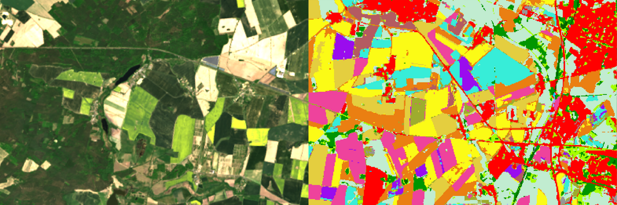
In work package 1 Spatio-temporal patterns of land cover and land use, we create an Earth observation (Landsat, Sentinel 2) data cube for the Baltic Sea Region and derive maps on land cover and its gradual changes since the mid-1980s. Together with colleagues we then explore selected processes related to research questions in the IFZO context. One focus is on the quantification of change processes in peatlands.
The maps from the previous work package together with digitized historical maps mark the core content of the Baltic Earth Observation and Geodata Repository, which is the aim of work package 2. This repository is a basic data infrastructure for the research at IFZO and the basis for collaborative projects that contribute to the Atlas of Fragmented Transformation.
In work package 3 Urban-Rural Gradients we put a special focus on the gradients of urban development. We reconstruct urban growth in the Baltic Sea Region over four decades, which were characterized by multiple political changes and fragmented developments. Together with the workgroup of Paula Prenzel, we explore how results from the Earth observation and geodata analysis can be combined with socio-demographic information.
- Arasumani, M., Thiel, F., Pham, V.-D., Hellmann, C., Kaiser, M., & van der Linden, S. (2023). Advancing peatland vegetation mapping by spaceborne imaging spectroscopy. Ecological Indicators, 154, 110665. https://doi.org/10.1016/j.ecolind.2023.110665
- Pham, V.-D., de Waard, F., Thiel, F., Bobertz, B., Hellmann, C., Nguyen, D.-V., Beer, F., Arasumani, M., Schwieder, M., Hartleib, J., Frantz, D., & van der Linden, S. (2024). An annual land cover dataset for the Baltic Sea Region with crop types and peat bogs at 30 m from 2000 to 2022. Scientific Data, 11(1), 1242. https://doi.org/10.1038/s41597-024-04062-w
- Pham, V.-D., Tetteh, G., Thiel, F., Erasmi, S., Schwieder, M., Frantz, D., & van der Linden, S. (2024). Temporally transferable crop mapping with temporal encoding and deep learning augmentations. International Journal of Applied Earth Observation and Geoinformation, 129, 103867. https://doi.org/10.1016/j.jag.2024.103867
- Pham, V.-D., Thiel, F., Frantz, D., Okujeni, A., Schug, F., & van der Linden, S. (2024). Learning the variations in annual spectral-temporal metrics to enhance the transferability of regression models for land cover fraction monitoring. Remote Sensing of Environment, 308, 114206. https://doi.org/10.1016/j.rse.2024.114206
Project overview
Period: 06/2021 - 05/2026
Funding: DLR / BMBF
Members:
Vu Dong Pham (Doctoral student);
Bernd Bobertz (Postdoctoral researcher);
Peter Stoll (Curator of historic map collection, associate);
Sebastian van der Linden (PI)
Partners:
Can Orhan (Doctoral student);
Paula Prenzel (PI)

